![](/images/other/stat-length.png)
![Trail Other activity Bad Ragaz - SG / pardiel - obersäss - pizolhütte - pardiel - Photo](https://media.geolcdn.com/t/1900/400/ext.pjpeg?maxdim=2&url=https%3A%2F%2Fstatic1.geolcdn.com%2Fsiteimages%2Fupload%2Ffiles%2F1545311037marcheuse_200dpi.jpg)
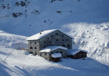
SG / pardiel - obersäss - pizolhütte - pardiel
denisewanderige
User
![Length](/images/other/stat-length.png)
Length
11.3 km
![Max alt](https://static1.geolcdn.com/siteimages/upload/files/1508320355ic_sort_altitude_max_24dp.png)
Max alt
2221 m
![Uphill gradient](https://static1.geolcdn.com/siteimages/upload/files/1508320355ic_sort_den_pos_24dp.png)
Uphill gradient
656 m
![Km-Effort](/images/other/stat-length.png)
Km-Effort
20 km
![Min alt](https://static1.geolcdn.com/siteimages/upload/files/1508320355ic_sort_altitude_min_24dp.png)
Min alt
1625 m
![Downhill gradient](https://static1.geolcdn.com/siteimages/upload/files/1508320355ic_sort_den_neg_24dp.png)
Downhill gradient
656 m
![Boucle](https://static1.geolcdn.com/siteimages/upload/files/16400158638029165_repeat_loop_refresh_sync_direction_icon.png)
Boucle
Yes
Creation date :
2014-12-11 00:00:00.0
Updated on :
2014-12-11 00:00:00.0
![Other activity](https://static1.geolcdn.com/sitytour/trail-icons/900.png)
--
Difficulty : Unknown
![Scan this QR Code to open this trail in the SityTrail application](https://capi.geolives.com/qq0zvz2zws4bq2lad0pu/sitytour/trails/19465/qr.png?size=200)
FREE GPS app for hiking
About
Trail Other activity of 11.3 km to be discovered at Sankt Gallen, Wahlkreis Sarganserland, Bad Ragaz. This trail is proposed by denisewanderige.
Description
Details (Wanderbeschrieb, Fotos, Dauer, Links, usw.) siehe unter:
http://www.wanderige.ch/wanderige_toure/2006/pizol/pizol.htm
Positioning
Country:
Switzerland
Region :
Sankt Gallen
Department/Province :
Wahlkreis Sarganserland
Municipality :
Bad Ragaz
Location:
Unknown
Start:(Dec)
Start:(UTM)
535268 ; 5204130 (32T) N.
Comments
Trails nearby
![Trail On foot Pfäfers - Pfäfers - Spig - Photo](https://media.geolcdn.com/t/375/260/960a57d7-2229-4f75-a454-13f455f6e1e8.jpeg&format=jpg&maxdim=2)
![On foot On foot](https://static1.geolcdn.com/sitytour/trail-icons/100.png)
Pfäfers - Spig
On foot
Easy
Pfäfers,
Sankt Gallen,
Wahlkreis Sarganserland,
Switzerland
![](/images/other/stat-length.png)
3.8 km | 7.5 km-effort
1h 41min
![](https://static1.geolcdn.com/siteimages/upload/files/16400158638029165_repeat_loop_refresh_sync_direction_icon.png)
No
![Trail On foot Pfäfers - Bad Pfäfers - Pfäfers - Photo](https://media.geolcdn.com/t/375/260/4c6ea9a3-1f12-4209-af1f-6fbd72b66fe4.jpeg&format=jpg&maxdim=2)
![On foot On foot](https://static1.geolcdn.com/sitytour/trail-icons/100.png)
Bad Pfäfers - Pfäfers
On foot
Easy
Pfäfers,
Sankt Gallen,
Wahlkreis Sarganserland,
Switzerland
![](/images/other/stat-length.png)
3.6 km | 6 km-effort
1h 21min
![](https://static1.geolcdn.com/siteimages/upload/files/16400158638029165_repeat_loop_refresh_sync_direction_icon.png)
No
![Trail On foot Vilters-Wangs - Garschlu - Bad Ragaz - Photo](https://media.geolcdn.com/t/375/260/ad10575f-3adb-4e89-9620-1a4c222a171a.jpeg&format=jpg&maxdim=2)
![On foot On foot](https://static1.geolcdn.com/sitytour/trail-icons/100.png)
Garschlu - Bad Ragaz
On foot
Easy
Vilters-Wangs,
Sankt Gallen,
Wahlkreis Sarganserland,
Switzerland
![](/images/other/stat-length.png)
8.7 km | 12.1 km-effort
2h 45min
![](https://static1.geolcdn.com/siteimages/upload/files/16400158638029165_repeat_loop_refresh_sync_direction_icon.png)
No
![Trail On foot Vilters-Wangs - 5-Seen-Wanderung - Photo](https://media.geolcdn.com/t/375/260/dev_293debdd-eb52-40e8-a7c4-af32ae64913b.jpeg&format=jpg&maxdim=2)
![On foot On foot](https://static1.geolcdn.com/sitytour/trail-icons/100.png)
5-Seen-Wanderung
On foot
Easy
Vilters-Wangs,
Sankt Gallen,
Wahlkreis Sarganserland,
Switzerland
![](/images/other/stat-length.png)
9.8 km | 18.1 km-effort
4h 7min
![](https://static1.geolcdn.com/siteimages/upload/files/16400158638029165_repeat_loop_refresh_sync_direction_icon.png)
No
![Trail On foot Vilters-Wangs - Garmil-Höhenwanderung - Photo](https://media.geolcdn.com/t/375/260/28ba02fa-c2ee-44af-8fc9-614ecdb77080.jpeg&format=jpg&maxdim=2)
![On foot On foot](https://static1.geolcdn.com/sitytour/trail-icons/100.png)
Garmil-Höhenwanderung
On foot
Easy
Vilters-Wangs,
Sankt Gallen,
Wahlkreis Sarganserland,
Switzerland
![](/images/other/stat-length.png)
6.2 km | 10.7 km-effort
2h 25min
![](https://static1.geolcdn.com/siteimages/upload/files/16400158638029165_repeat_loop_refresh_sync_direction_icon.png)
No
![Trail Other activity Bad Ragaz - st_ral_10_03 - Photo](https://media.geolcdn.com/t/375/260/ext.jpg?maxdim=2&url=https%3A%2F%2Fstatic1.geolcdn.com%2Fsiteimages%2Fupload%2Ffiles%2F1545311037marcheuse_200dpi.jpg)
![Other activity Other activity](https://static1.geolcdn.com/sitytour/trail-icons/900.png)
st_ral_10_03
Other activity
Very easy
Bad Ragaz,
Sankt Gallen,
Wahlkreis Sarganserland,
Switzerland
![](/images/other/stat-length.png)
46 km | 66 km-effort
17h 1min
![](https://static1.geolcdn.com/siteimages/upload/files/16400158638029165_repeat_loop_refresh_sync_direction_icon.png)
No
![Trail Walking Vilters-Wangs - hike22 - Photo](https://media.geolcdn.com/t/375/260/ext.jpg?maxdim=2&url=https%3A%2F%2Fstatic1.geolcdn.com%2Fsiteimages%2Fupload%2Ffiles%2F1553511878bg_sport_marche.png)
![Walking Walking](https://static1.geolcdn.com/sitytour/trail-icons/101.png)
hike22
Walking
Very easy
Vilters-Wangs,
Sankt Gallen,
Wahlkreis Sarganserland,
Switzerland
![](/images/other/stat-length.png)
10.6 km | 19.4 km-effort
Unknown
![](https://static1.geolcdn.com/siteimages/upload/files/16400158638029165_repeat_loop_refresh_sync_direction_icon.png)
No
![Trail On foot Bad Ragaz - Heidipfad - Photo](https://media.geolcdn.com/t/375/260/ext.jpg?maxdim=2&url=https%3A%2F%2Fstatic1.geolcdn.com%2Fsiteimages%2Fupload%2Ffiles%2F1545311037marcheuse_200dpi.jpg)
![On foot On foot](https://static1.geolcdn.com/sitytour/trail-icons/100.png)
Heidipfad
On foot
Easy
Bad Ragaz,
Sankt Gallen,
Wahlkreis Sarganserland,
Switzerland
![](/images/other/stat-length.png)
4 km | 5.8 km-effort
1h 19min
![](https://static1.geolcdn.com/siteimages/upload/files/16400158638029165_repeat_loop_refresh_sync_direction_icon.png)
Yes
![Trail On foot Fläsch - Flaesch (CH) - Neuwald (CH) - Maels - Photo](https://media.geolcdn.com/t/375/260/ext.jpg?maxdim=2&url=https%3A%2F%2Fstatic1.geolcdn.com%2Fsiteimages%2Fupload%2Ffiles%2F1545311037marcheuse_200dpi.jpg)
![On foot On foot](https://static1.geolcdn.com/sitytour/trail-icons/100.png)
Flaesch (CH) - Neuwald (CH) - Maels
On foot
Easy
Fläsch,
Grisons,
Landquart,
Switzerland
![](/images/other/stat-length.png)
8.2 km | 13.6 km-effort
3h 5min
![](https://static1.geolcdn.com/siteimages/upload/files/16400158638029165_repeat_loop_refresh_sync_direction_icon.png)
No